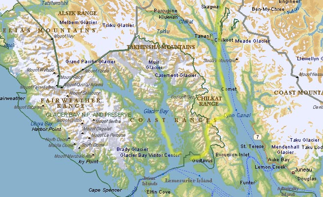
[back to InetPix] [north to Alaska][Just the pix]
With Burgie safely deposited at a kennel, we drove from Whitehorse to Skagway to catch our flight to Gustavus.
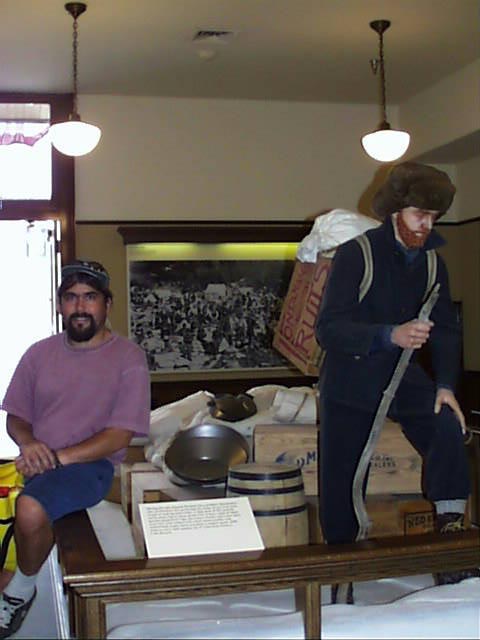
The road from Whitehorse to Skagway follows part of the route used during the Klondike gold rush. An exhibit at a museum in Skagway shows the years supply of food which the Canadian Mounties required stampeders to bring across the border. These folks either made dozens of trips bringing up portions of the gear to the checkpoint, or used pack animals or dogs. Thankfully this requirement no longer exists.
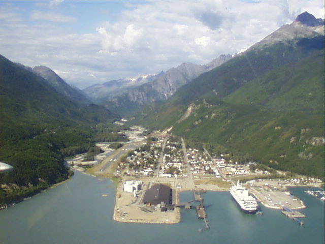
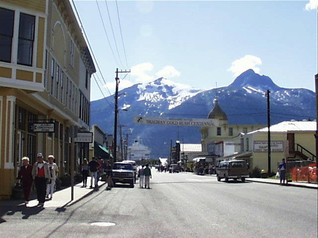
Skagway now caters to the many tour boats that stop here on their way to Glacier Bay. The main street maintains a turn of the century appearance with original buildings and wooden sidewalk.
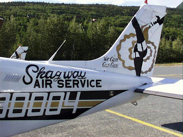
Our flight was on Skagway Air Service, whose motto is "We can "can can"".
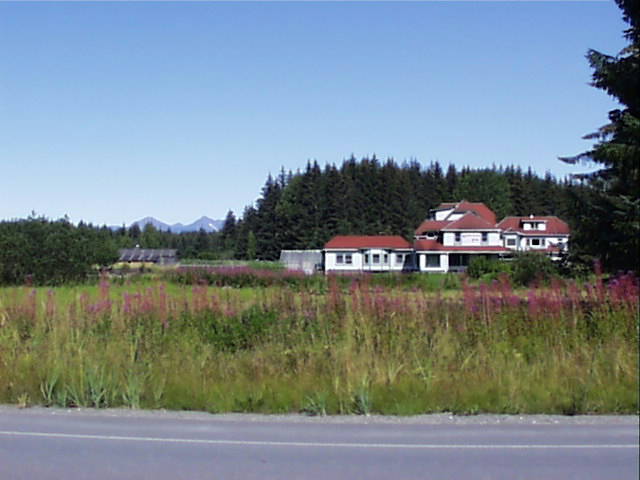
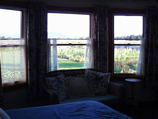
Certainly the nicest accomodations of our trip were at the Gustavus Inn B&B. Home cooked meals with local fish and vegetables from the garden were especially welcome after 6 evenings of dehydrated dinners.
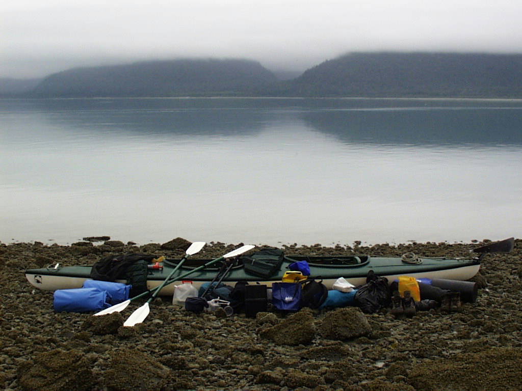
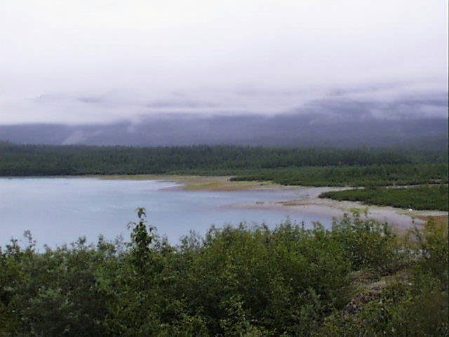
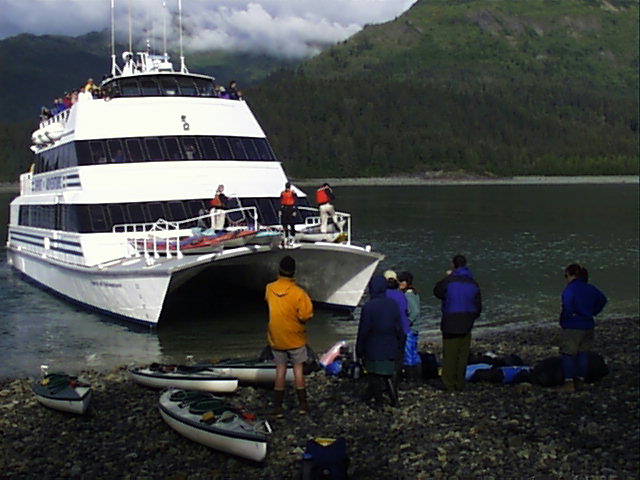
We put our kayak aboard the boat used to take day excursions through Glacier Bay. This vessel also acts as ferry for three drop off points for campers and kayakers. We got dropped off the next morning at about 10 at Seebree island which is at the base of the fork between the east and west arms of Glacier Bay. Since the east arm is closed to all commercial boats we chose this route.
Kayak orientation consisted of a lot of discussion of closed areas and bear procedures and about 5 minutes on the water the day before. After being dropped off on the island, it took us about an hour to figure out how to cram all of our gear into the kayak, still leaving room for ourselves.
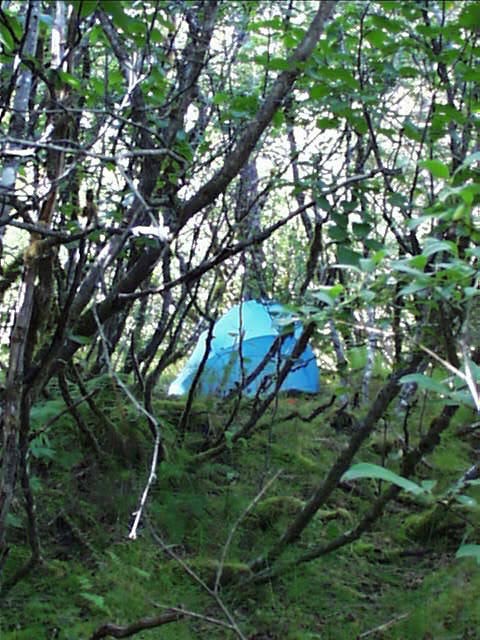
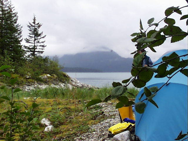
Finding a campsite proved to be slightly more difficult than we anticipated. There are no official campsites in Glacier Bay. It is a wilderness area and you can camp anywhere, but you must consider access to fresh water, some area to set up a tent, and the boat landing at both high and low tide.
Our first site was a bit cramped, but passable.
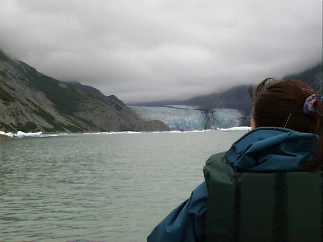
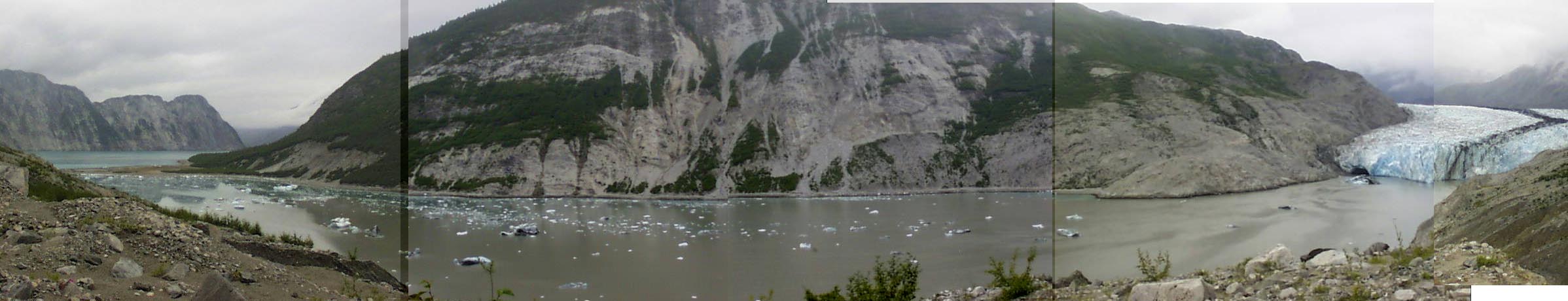
Our next site was at Wolf Pt. about 3 miles south of the opening to McBride Glacier. We stayed here two nights and did a day trip to McBride. This allowed us to not have to repack the kayak and reestablish camp (two somewhat tedious exercises).
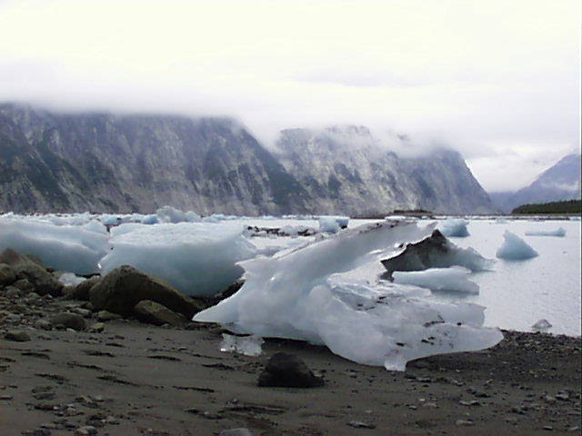
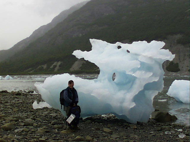
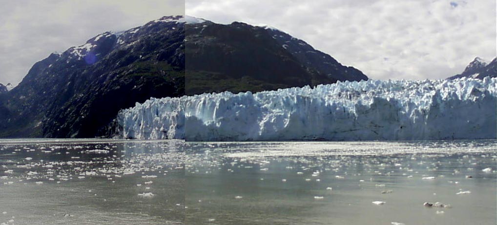
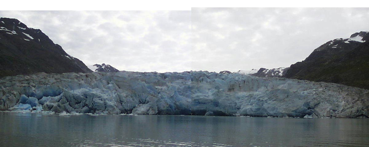
The high point of our trip was paddling around and walking along the shore of the inlet formed by McBride Glacier. The icebergs which are created by the calving of the Glacier beach themselves at low tide creating a bizarre landscape of ice varying from 1 pound blocks to larger than car sized figures.
Returning from McBride, we intended to camp again at Morse Glacier outwash, but after stopping at a cove for lunch, the water got pretty choppy and the wind picked up, so we opted to camp at this cove. The next morning we found bear scat about a foot from our tent (not sure if it was there the night before).
The rock cairn on Seebree indicates the pickup point for the boat. We found our way back and camped here the last night. On the beach we found a rock bearing a striking resemblance to piglet.
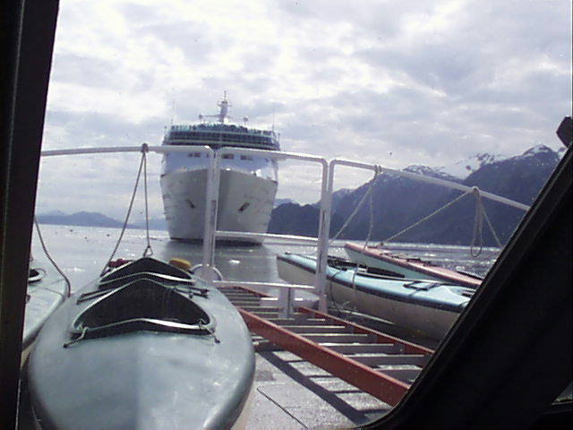
After our pickup we took the remainder of the boat tour with the other tourists on board. Hilights were the grizzlies seen on shore, and more tidal glaciers, including Margorie and Grand Pacific. Also got a feel for the size of some of these cruise ships.